ARIA is a collaboration between JPL and Caltech to exploit radar and optical remote sensing, GPS, and seismic observations for hazard science and response.
ARIA investigates the processes and impacts of earthquakes, volcanoes, landslides, fires, subsurface fluid movement and other natural hazards by applying modern geodesy, merged with ground-based observations, to help improve our resilience to such events. The project develops state-of-the-art ground deformation measurements change detection methods and physical models using GPS and synthetic aperture radar observations, automating the required large-scale processing, and producing basic data products for the science community.
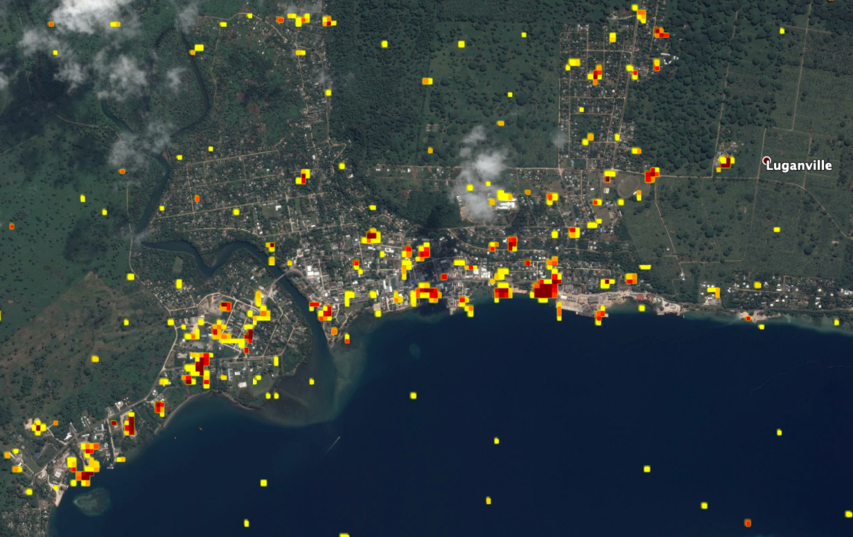
As populations grow, response to natural disasters is becoming an increasingly important part of link between science and society. We are developing tools to use the growing networks of ground-based GPS sensors and constellations of imaging satellites for hazard monitoring and response. With these new tools, we anticipate the improvement of situational awareness immediately following disasters.
ARIA project logos can be found on the logos page.