MEDIA | May 6, 2013
Damage detection in New York City hit by Hurricane Sandy
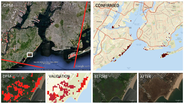
ARIA team responded to Hurricane Sandy and manually produced a damage proxy map (DPM) of New York City using X-band radar data from COSMO-SkyMed satellites. The team coordinated a group of GIS experts to validate each pixel of the DPM to remove false positives, comparing with pre-event Google Earth image and post-event NOAA's aerial photographs. The data was acquired on Day 5, the DPM was created on Day 11, and the validated product on Day 15. The product was delivered to the International Charter, and the response report is available online at http://www.giscorps.org/index.php?option=com_content&task=view&id=129&Itemid=63 The results demonstrate great potential of InSAR data and future automated system ARIA team is building.