ARIA in the News
-
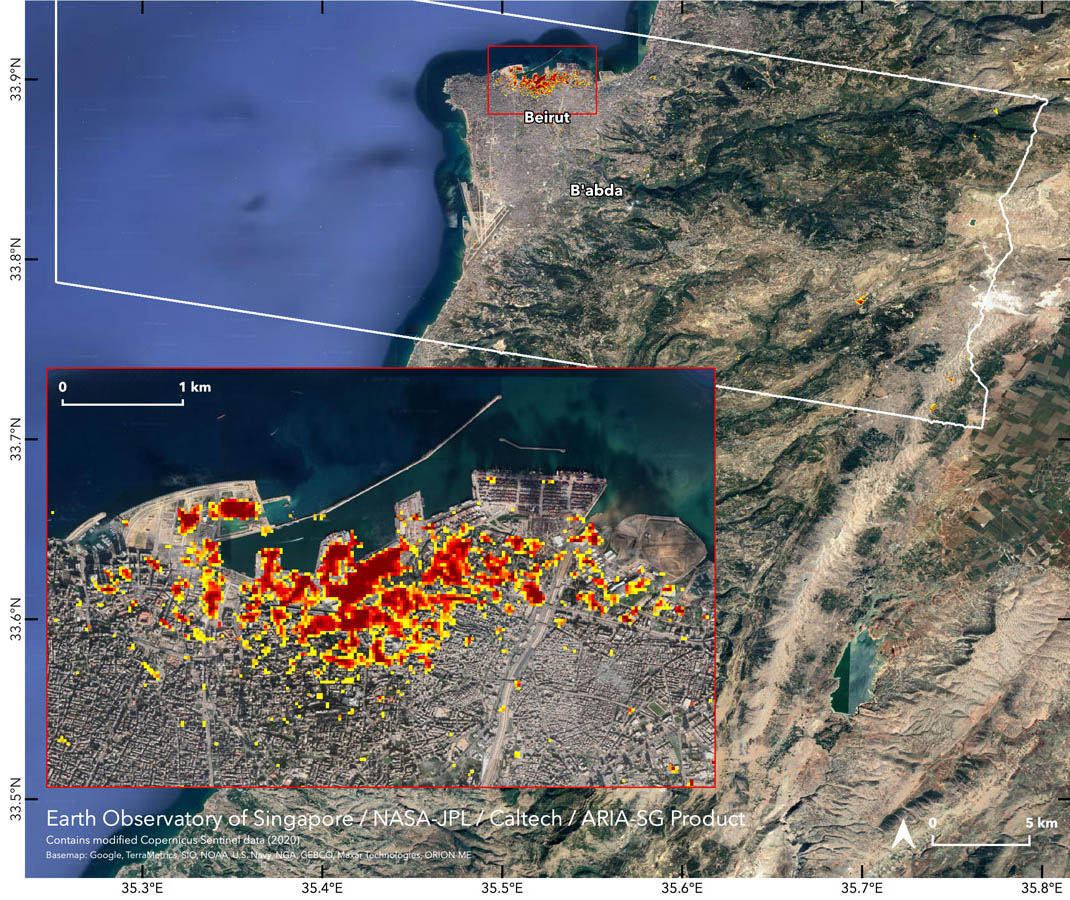
NASA Maps Beirut Blast Damage
NASA Maps Beirut Blast Damage -
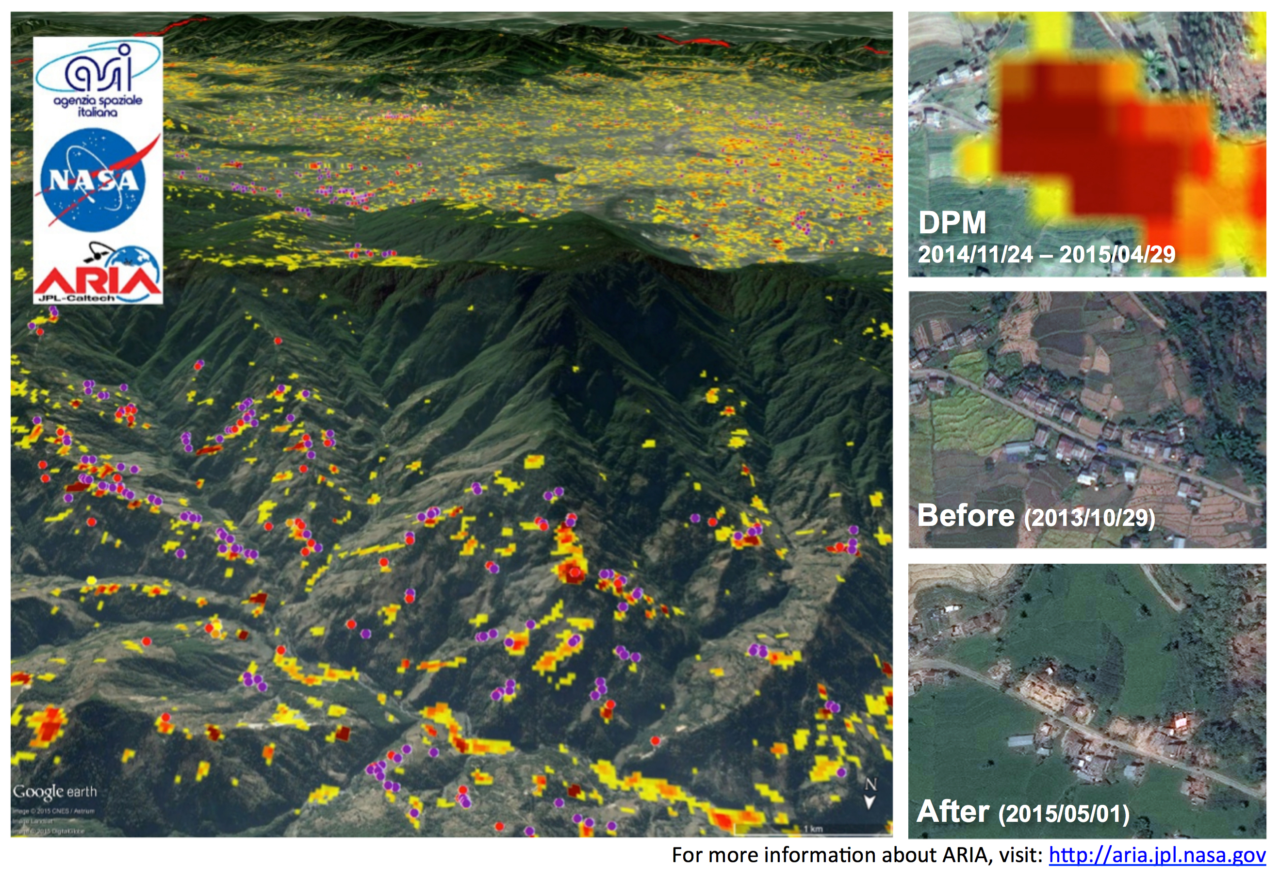
NASA Map Reveals a New Landslide Risk Factor
NASA Map Reveals a New Landslide Risk Factor -
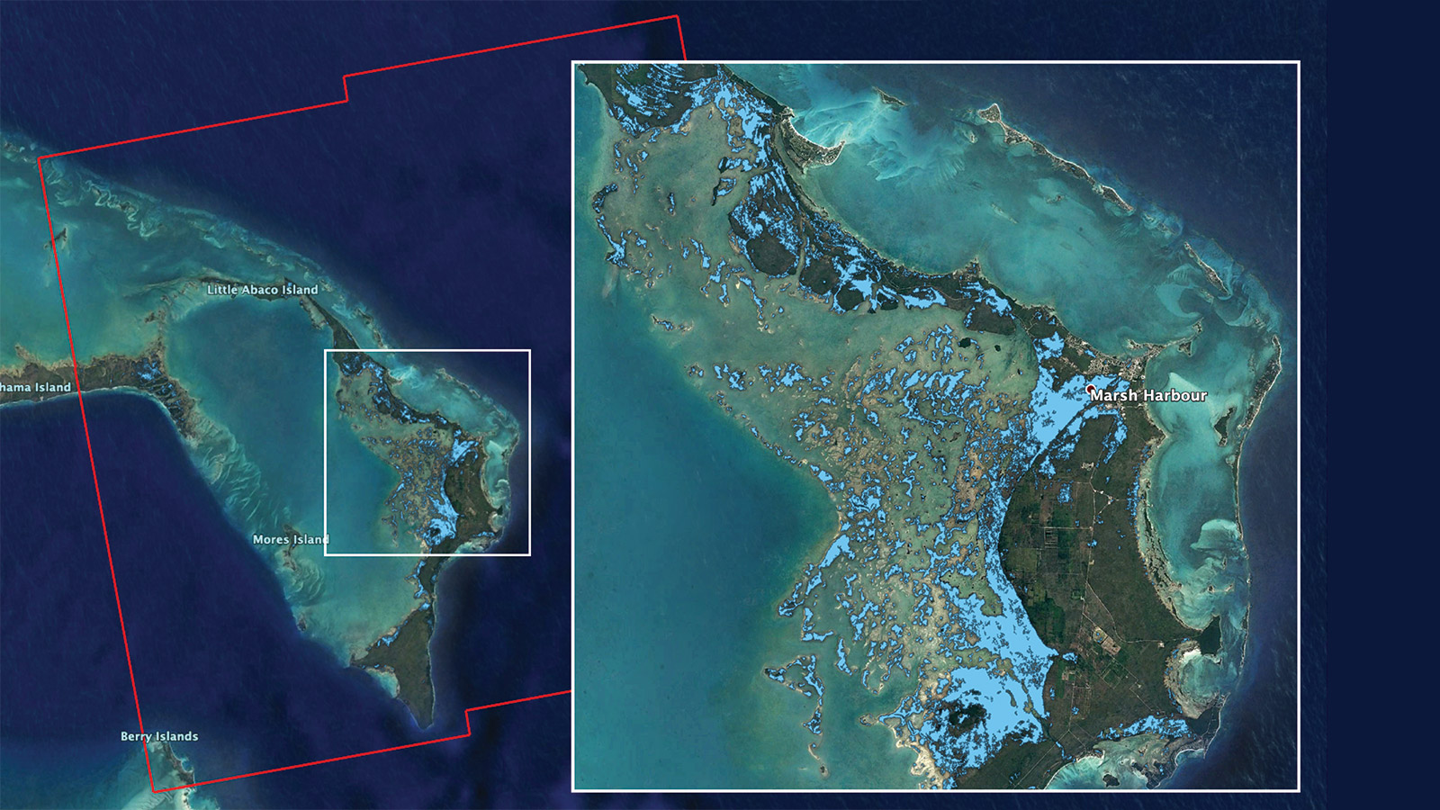
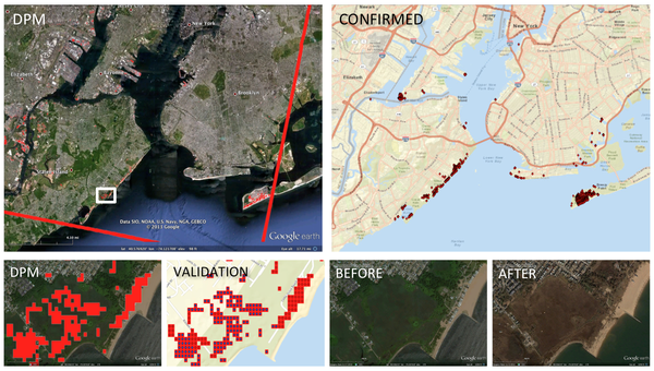
NASA's ARIA Team Maps Flooding in the Bahamas
NASA's ARIA Team Maps Flooding in the Bahamas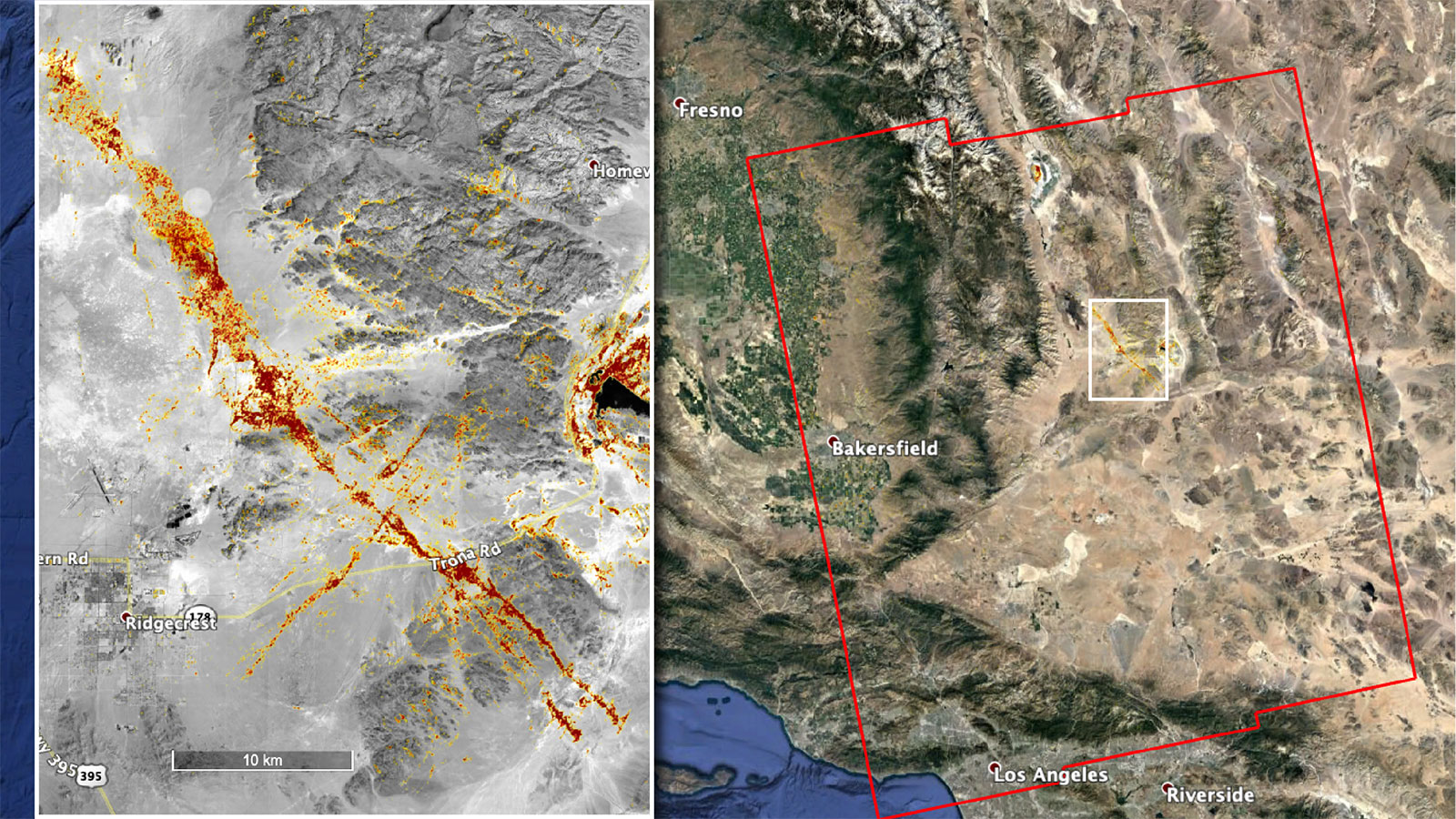
NASA's ARIA Team Maps California Quake Damage
NASA's ARIA Team Maps California Quake Damage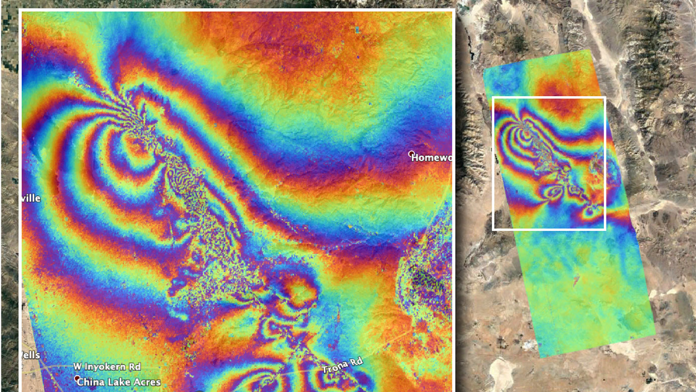
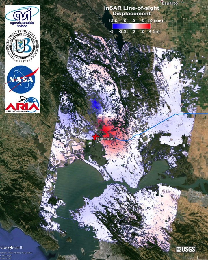
NASA Maps Surface Changes From California Quakes
NASA Maps Surface Changes From California Quakes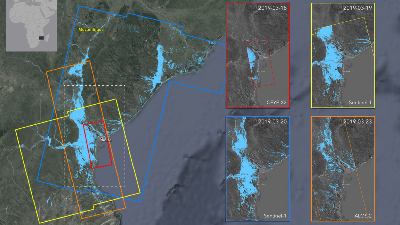
Satellites Image Mozambique Flooding After Cyclone
Satellites Image Mozambique Flooding After Cyclone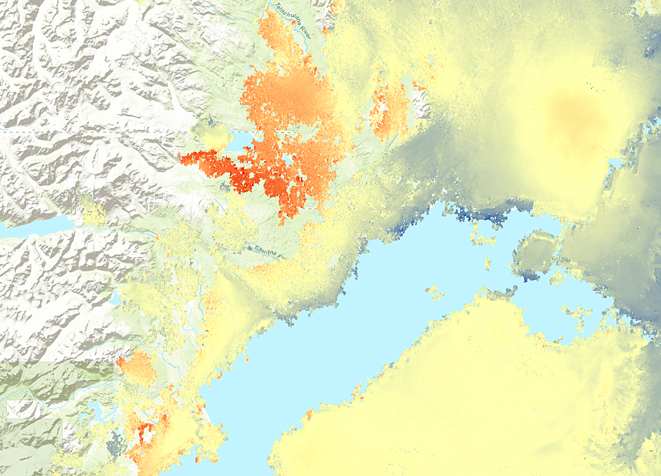
Satellite Map Shows Deformation Following Alaska Earthquake
Satellite Map Shows Deformation Following Alaska Earthquake
Assisting Those Fighting the California Wildfires on This Week @NASA
Assisting Those Fighting the California Wildfires on This Week @NASA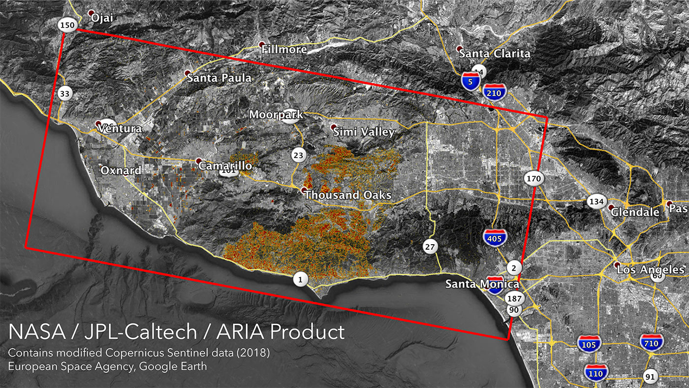
NASA's ARIA Maps California Wildfires from Space
NASA's ARIA Maps California Wildfires from Space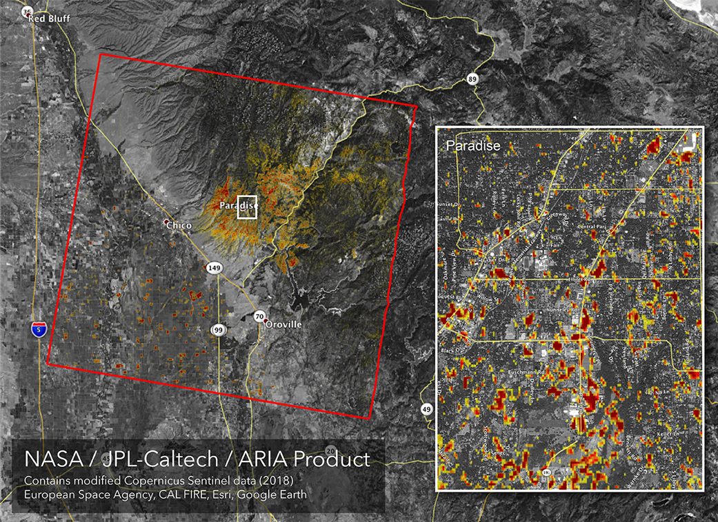
Updated NASA Damage Map of Camp Fire from Space
Updated NASA Damage Map of Camp Fire from Space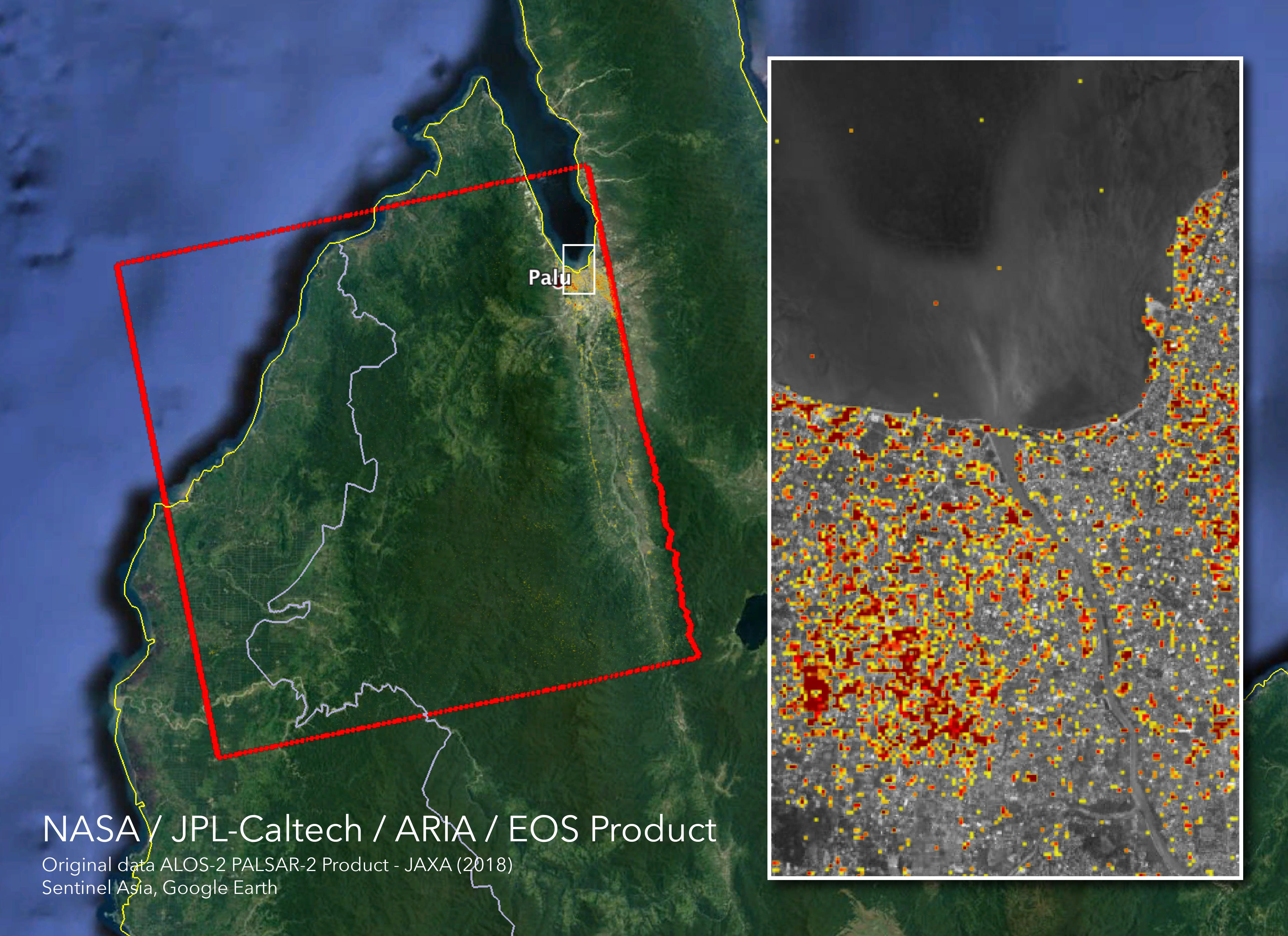
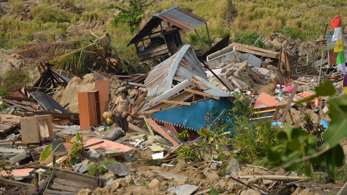
NASA's ARIA Maps Indonesia Quake, Tsunami Damage
NASA's ARIA Maps Indonesia Quake, Tsunami Damage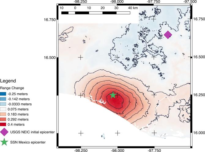
NASA's ARIA Project Generates New Satellite-Derived Map of Ground Deformation from Latest Mexico Quake
NASA's ARIA Project Generates New Satellite-Derived Map of Ground Deformation from Latest Mexico Quake
Tonga Cyclone Damage Mapped by NASA's ARIA Team
Tonga Cyclone Damage Mapped by NASA's ARIA Team
NASA-Produced Map Shows Extent of Southern California Wildfire Damage
NASA-Produced Map Shows Extent of Southern California Wildfire Damage
NASA Damage Map Aids California Wildfire Response
NASA Damage Map Aids California Wildfire Response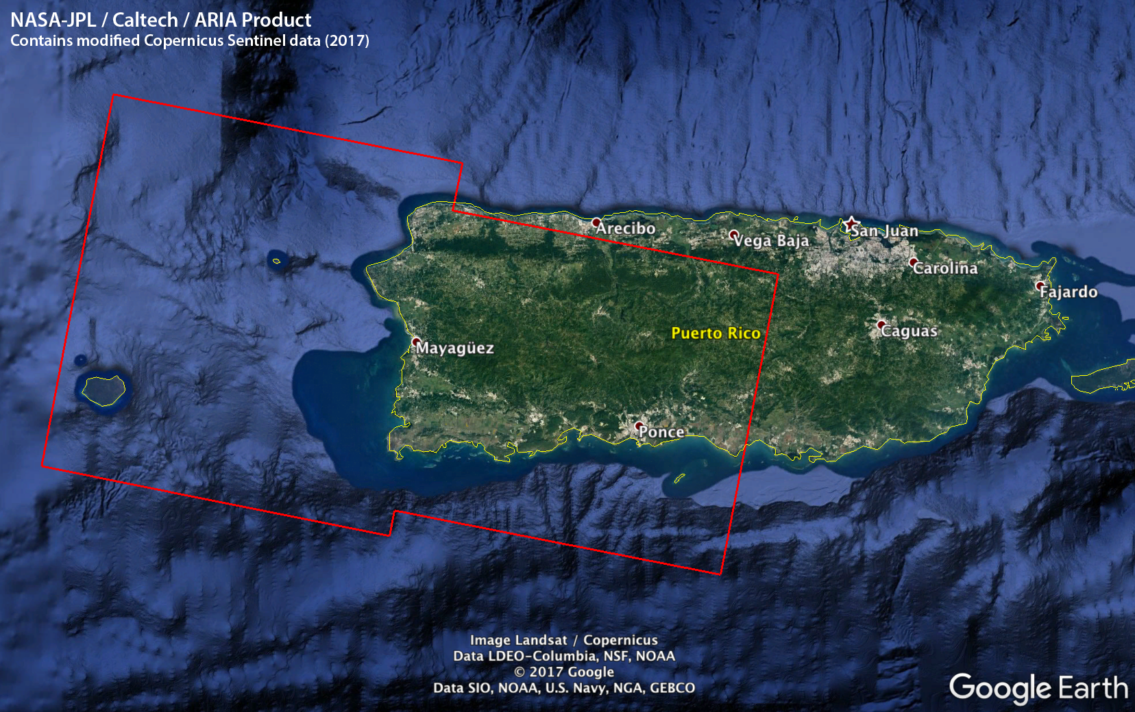
ARIA Damage Proxy Map of Puerto Rico after Hurricane Maria
ARIA Damage Proxy Map of Puerto Rico after Hurricane Maria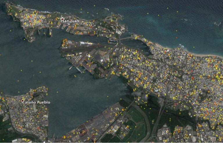
NASA Maps Damage in Puerto Rico to Assist Relief Efforts
NASA Maps Damage in Puerto Rico to Assist Relief Efforts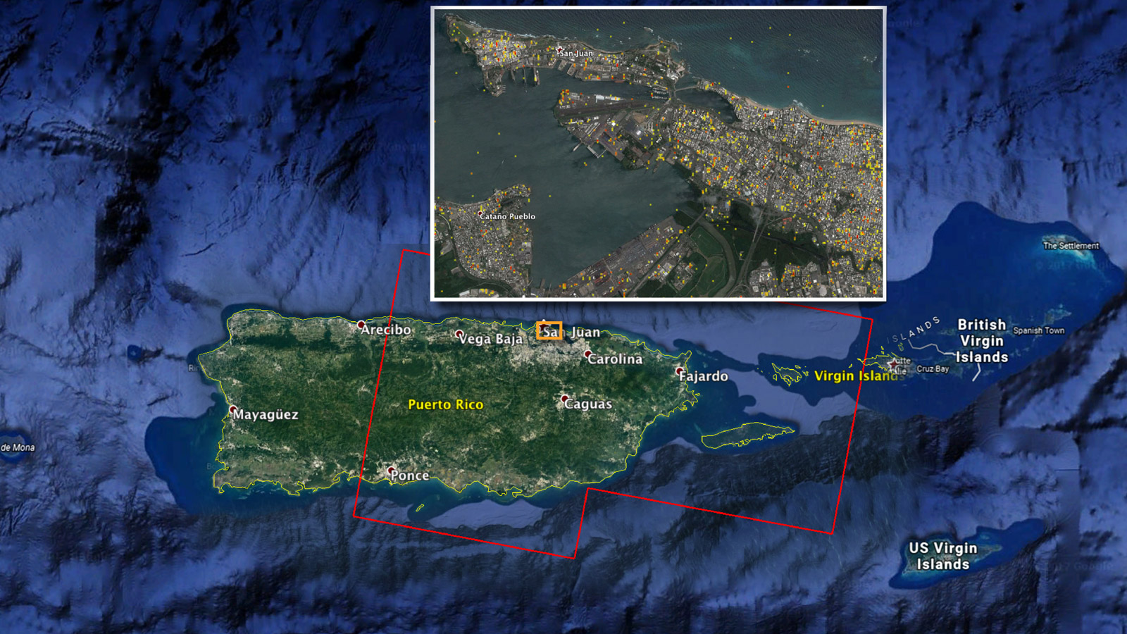
NASA Damage Map Aids Puerto Rico Hurricane Response
NASA Damage Map Aids Puerto Rico Hurricane Response
Satellite Data of Puerto Rico Identifies Possible Damage Areas
Satellite Data of Puerto Rico Identifies Possible Damage Areas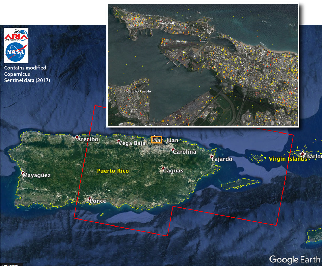
NASA Damage Map Aids FEMA's Hurricane Maria Rescue Operation in Puerto Rico
NASA Damage Map Aids FEMA's Hurricane Maria Rescue Operation in Puerto Rico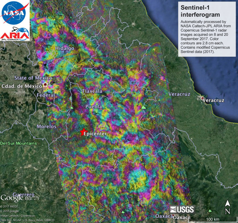
Sentinel-1 Interferogram for September 2017 Raboso-Puebla Earthquake in Mexico
Sentinel-1 Interferogram for September 2017 Raboso-Puebla Earthquake in Mexico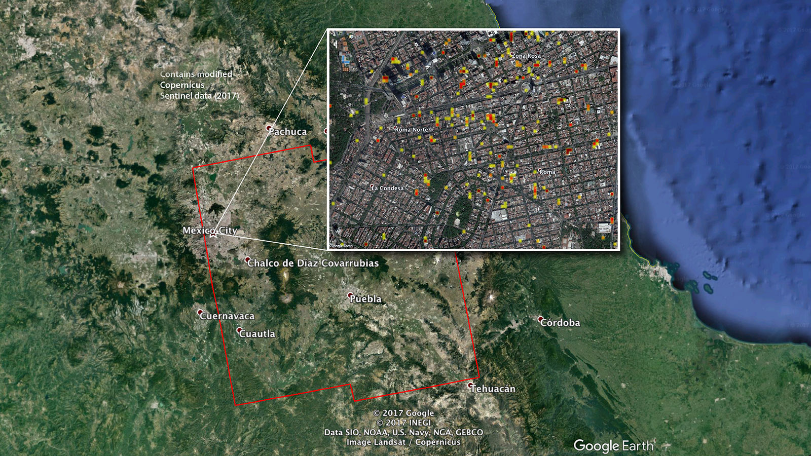
NASA-Produced Damage Maps May Aid Mexico Quake Response
NASA-Produced Damage Maps May Aid Mexico Quake Response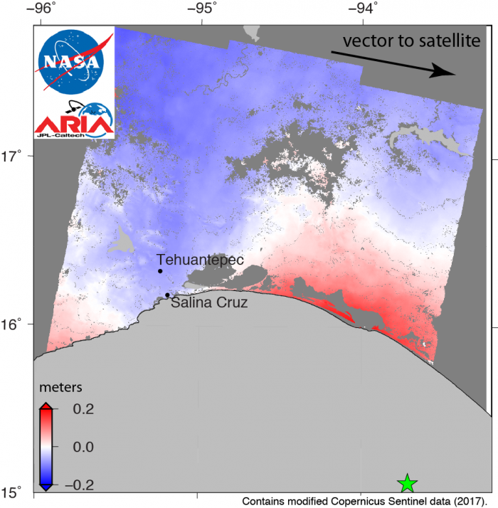
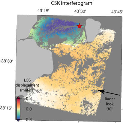
Sentinel-1 Radar Shows Ground Motion From Sept. 2017 Oaxaca-Chiapas, Mexico Quake
Sentinel-1 Radar Shows Ground Motion From Sept. 2017 Oaxaca-Chiapas, Mexico Quake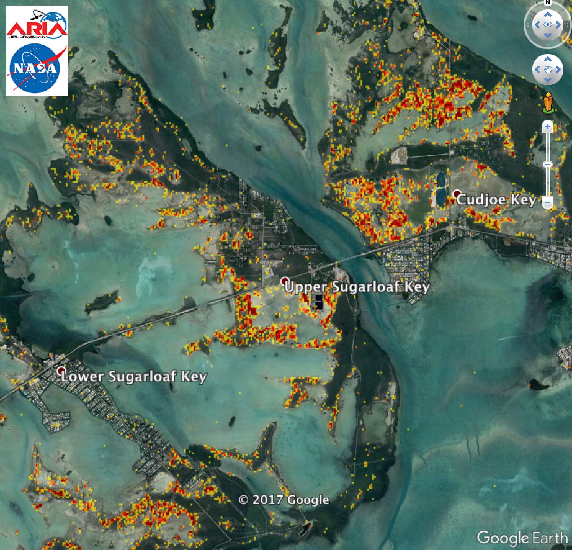
ARIA Damage Proxy Map of Southern Florida from Hurricane Irma
ARIA Damage Proxy Map of Southern Florida from Hurricane Irma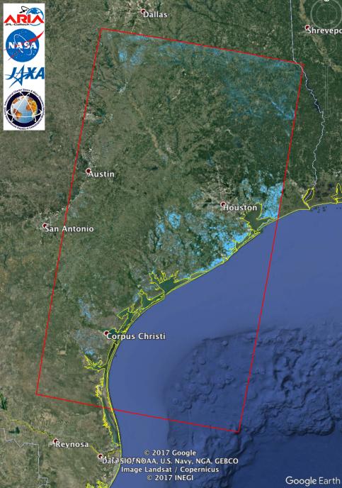
Updated NASA Satellite Flood Map of Southeastern Texas (ALOS-2 Data)
Updated NASA Satellite Flood Map of Southeastern Texas (ALOS-2 Data)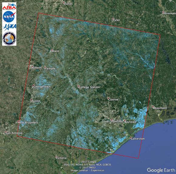
Extent of Texas Flooding Shown in New NASA Map
Extent of Texas Flooding Shown in New NASA Map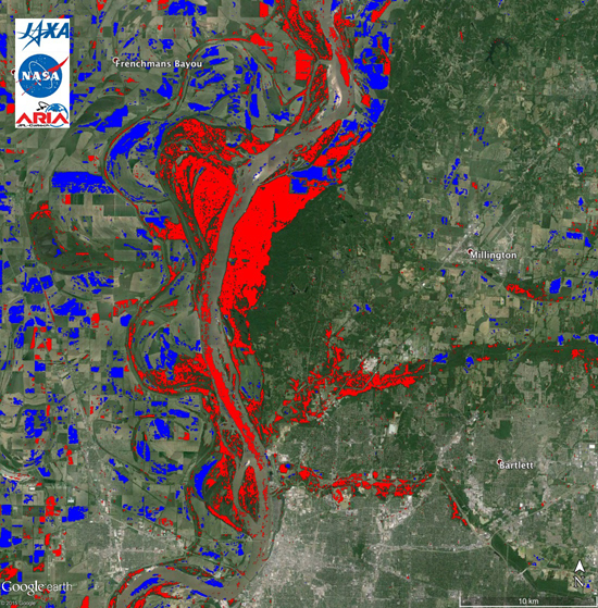
Dec 2015 - Jan 2016 US Midwest Floods
Dec 2015 - Jan 2016 US Midwest Floods