MEDIA | August 27, 2014
M6.0 South Napa Earthquake, August 24, 2014
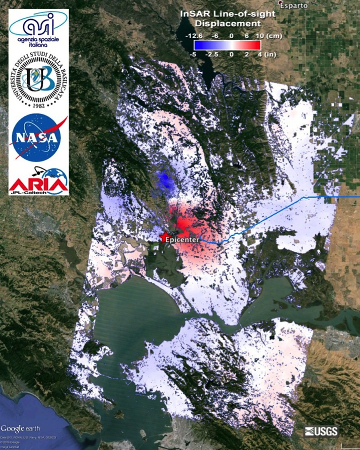
In response to the August 24, 2014 M6.0 South Napa Earthquake, the ARIA team has generated coseismic GPS displacements, coseismic InSAR displacements, and a Damage Proxy Map. The above image is an Interferometric Synthetic Aperture Radar (InSAR) map of coseismic displacement (unwrapped interferogram) in the radar line-of-sight (LOS, 29 degrees from vertical and roughly west) caused by the 2014/08/24 M6.0 South Napa Earthquake, California. Derived from COSMO-SkyMed data acquired on 2014/07/26 and 2014/08/27. Processed by ARIA team at JPL-Caltech in collaboration with the Italian Space Agency (ASI) and University of Basilicata. The epicenter indicated with the red star is from USGS NEIC. The blue line indicates the North Bay Aqueduct. COSMO-SkyMed data (c) ASI 2014.
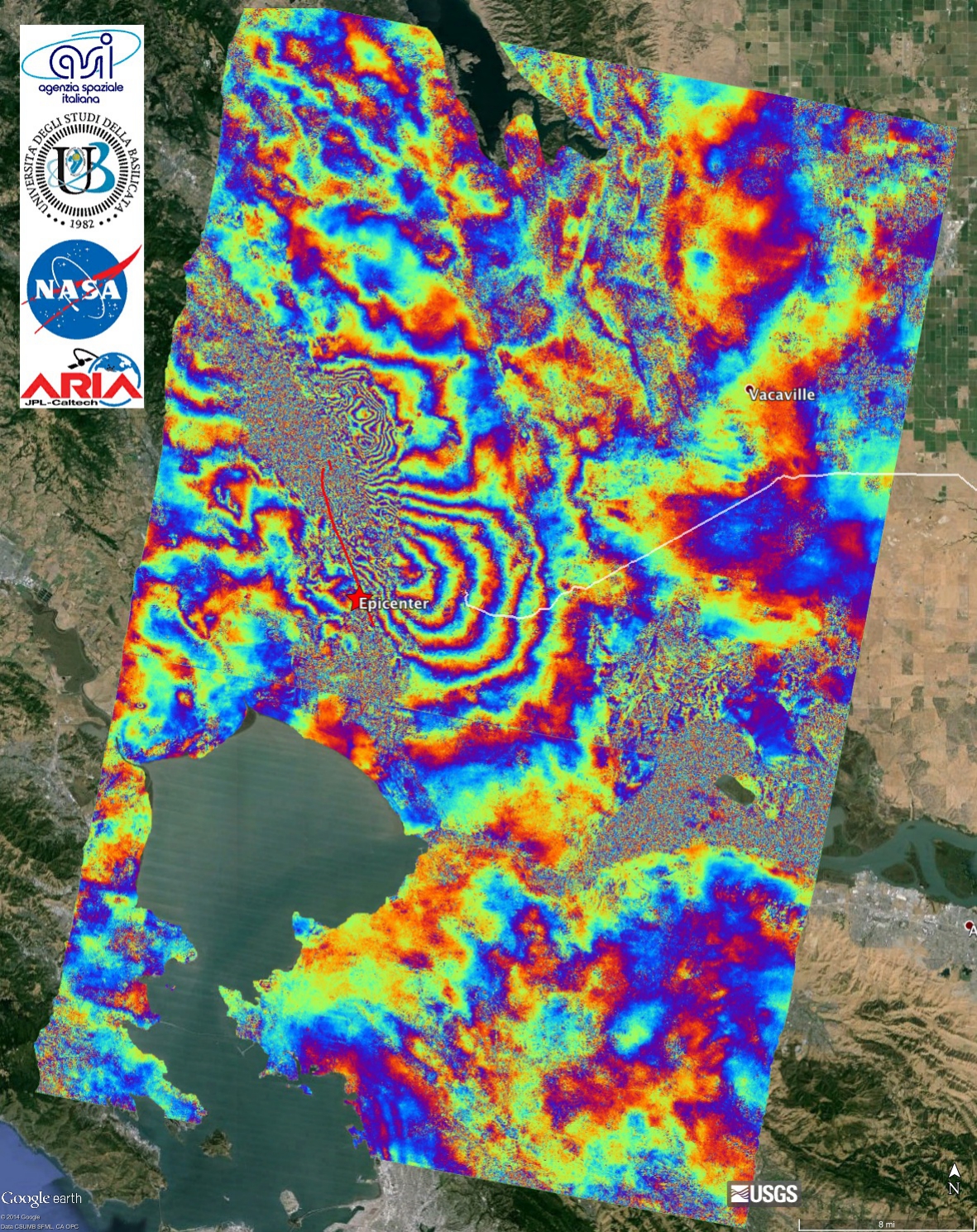
These results have been posted to the California Earthquake Clearinghouse and Southern California Earthquake Center Response Forum. The InSAR displacement maps are being used by field geologist to identify additional surface fault ruptures.
Image files with interferograms can be downloaded from the following links:
Coseismic InSAR Displacements KMZ file
Coseismic InSAR Displacements JPG file
Wrapped Interferogram KMZ file
Wrapped Interferogram JPG
An Image file with Damage Proxy Map can be downloaded from:
KMZ file
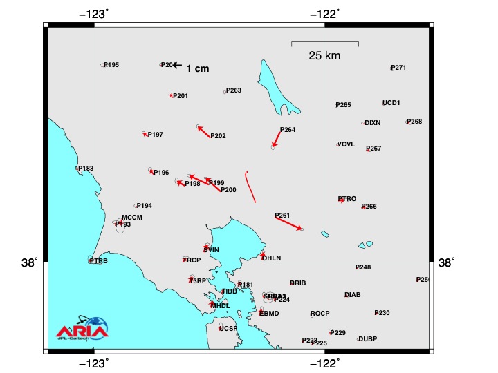
Files with GPS results can be downloaded here:
Map of Horizontal Displacements
Table with Offset Values
These results have been posted to the California Earthquake Clearinghouse and Southern California Earthquake Center Response Forum. The InSAR displacement maps are being used by field geologist to identify additional surface fault ruptures.
Image files with interferograms can be downloaded from the following links:
Coseismic InSAR Displacements KMZ file
Coseismic InSAR Displacements JPG file
Wrapped Interferogram KMZ file
Wrapped Interferogram JPG
An Image file with Damage Proxy Map can be downloaded from:
KMZ file
Files with GPS results can be downloaded here:
Map of Horizontal Displacements
Table with Offset Values