Panoply
Panoply supports arrays in NETCDF and HDF formats.
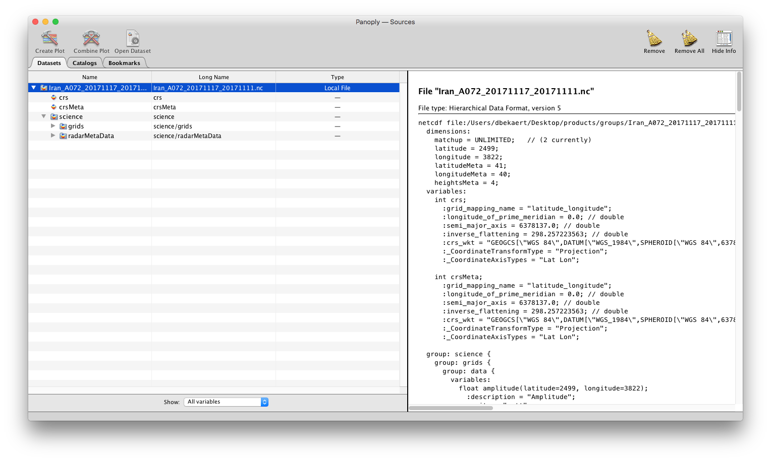
Retrieve an overview of the file content
> Open the file using panoply
Output:
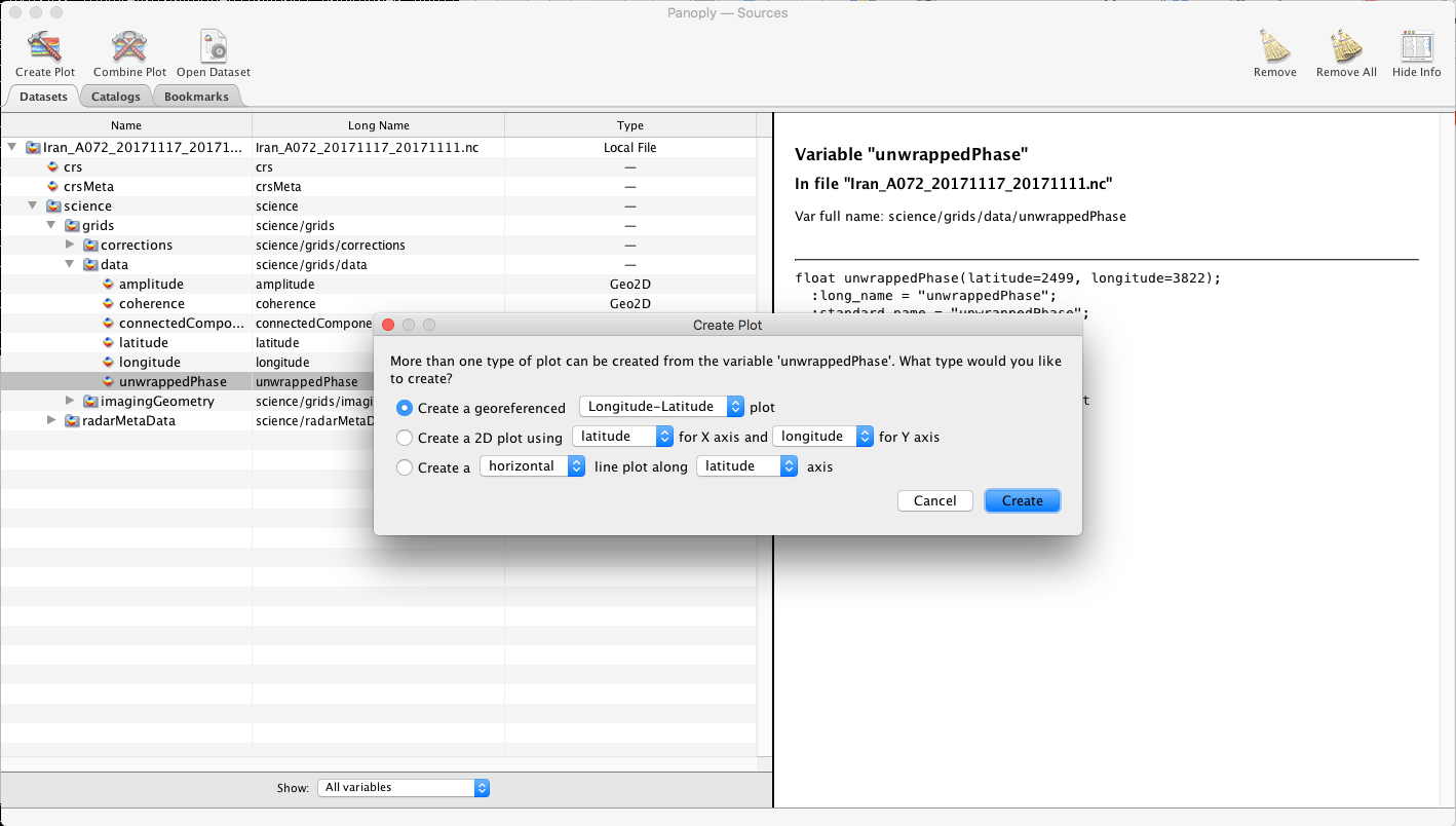
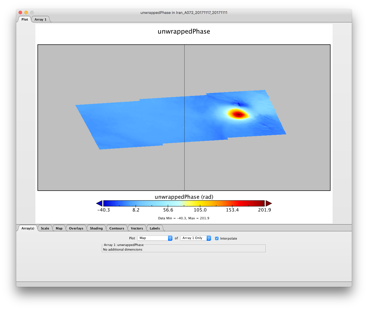
Visualization of the unwrapped phase
> browse to the “unwrappedPhase” dataset and double click to generate the longitude and latitude georeferenced plot.
Output: